Day 50 (22.0 miles)
Posted in : LEJOG on by : Nick
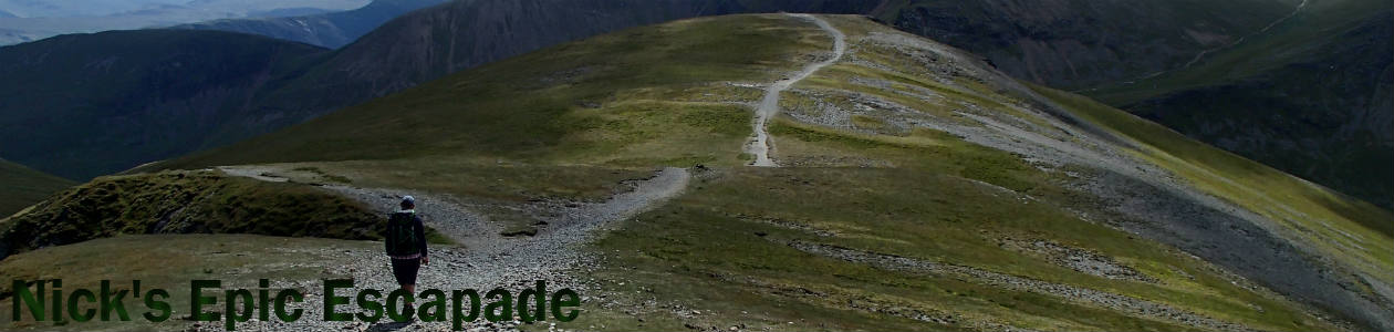
Innerleithen to West Linton
Today was definitely the hardest day so far. Not just because of the weather… The terrain, route finding and confidence in what I was doing all played a part.
When planning this adventure I naively believed that the only thing that could ruin the experience (apart from injury & other people) was long days of constant rain. I’m starting to realise that ‘strong winds’ could also scupper things.
After seeing the weather forecast I decided to start my day by walking to Peebles along the road instead of choosing the higher ground through Cardrona Forest & Kailzie Hill (485m). As I walked into Peebles I was starting to regret my decision as the wind hadn’t been as bad as the forecast had promised.
However, on the ascent out of Peebles I realised what a good decision I’d made. Approaching the relay station on Hamilton Hill the wind was definitely starting to become a hindrance, but I was aiming for the trig point on White Meldon (427m).
I eventually found a path that would take me to the summit (it seems climbing barbed wire fences is all part of the fun to my guidebook author) on the way up I was being blown all over the place, at the top breathing was the least of my worries, my main priority was preventing myself from becoming airborne! When I get to trig points I’d normally take a selfie, well that was out of the question here.
Once down, in the lee of Black Meldon, I had a forestry section to navigate. Now these are difficult in most situations. But using a Landranger map (1:50,000) it’s almost impossible. Plus, I’d walk off the map in about a mile anyway. Then I’d have no map for the last 7 miles of the day (I didn’t think it worth buying a whole map for a tiny bit in the corner).
Leaving the plantation I didn’t know where I was, where I was going or even what I was doing there. I was just blindly following my GPS arrow. (Hopefully this is the last time I’ll have no map).
It was with some relief that I re-entered some kind of civilisation (Romanno Bridge). – Live Tracking plotted a point in the wrong place before that – On the downside I had about 3 miles of road to walk along to get to West Linton.
Tomorrow looks like a tough day on paper….
Some stats:
Mileage count: 868.9
Pint count: 190
economy: 36.6mpg
Malt Whisky count: 11
4 thoughts on Day 50 (22.0 miles)
Sounds tough. Stay positive, you’re doing great! 🙂
Be careful Nick and Good Luck x
A tough day Nick but look what you’ve achieved so far: 868 miles, including the whole of England! Plus the not insignificant figure of 190 pints of beer.
sunshine on the way mate then it will be sunshine all the way.